Deep out in the Pacific Ocean, minor changes in water temperature are slowly catching the attention of climate change scientists.
The changes may portend the return of the El Niño climate pattern in the second half of 2026 -- and along with it, an unusually hot summer and extreme weather patterns worldwide.
El Niño is actually part of a larger climate pattern referred to as the El Niño-Southern Oscillation, or ENSO. ENSO is a climate pattern that is based on the interaction between the waters of the Pacific Ocean and the atmosphere that is directly above it.
This climate pattern fluctuates every few years between two different conditions: El Niño, when waters in the Pacific Ocean are warmer than normal, and La Niña, when they are cooler.
How Are Predictions Made?
Under normal conditions, strong trade winds in the Pacific Ocean force warm water to move towards Asia and Australia. This allows cold water to rise along the coast of South America.
However, during an El Niño event, trade winds become weaker. Warm waters move eastward across the Pacific towards the Americas, which changes weather patterns globally.
Unlike predicting the amount of rainfall the next day, El Niño prediction is a complex process where scientists observe the slow development of the ocean-atmosphere system over a period of time.
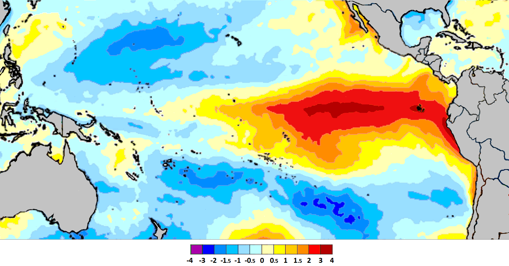
- The most important factor is the rise in the sea surface temperatures over a region of the Pacific Ocean called the Niño 3.4 region. If the temperatures rise by about half a degree Celsius above the average over a period of time, it is considered that the conditions for El Niño are developing.
- Another factor is the formation of clusters of hot water, which move towards the east and eventually rise to the surface, contributing to the rise in air temperatures.
- Lastly, a slowing down or reversal of trade winds from the west to the east is a factor. This causes warm waters to move from the west to the east, leading to the transition from La Niña to El Niño.
Even with modern technology, forecasting the phenomenon remains difficult. Spring is often the most uncertain period for predictions because ocean-atmosphere signals are weaker, a challenge scientists sometimes call the “spring predictability barrier.”
Impact On Weather
Despite all of this uncertainty, however, recent observations indicate that conditions are trending towards El Niño by late summer or fall 2026.
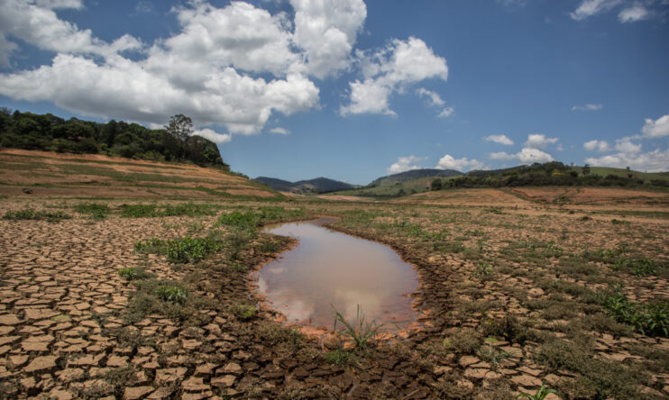
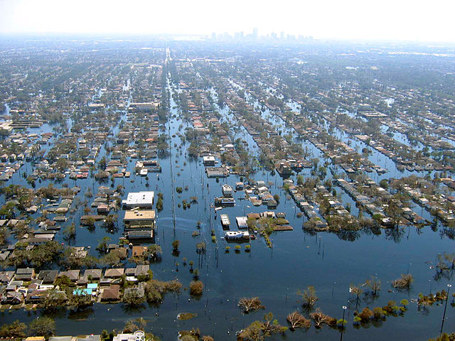
History has demonstrated the strength of this phenomenon. The 1982-1983 El Niño caused devastating floods in parts of the Americas, while severe droughts affected Australia and Indonesia. The 1997-1998 El Niño was the strongest on record, causing widespread storms, landslides, and disruptions to marine life in the Pacific Ocean. The 2015-2016 El Niño contributed to the hottest temperatures globally.
If an El Niño event materializes later this year, it could result in a temporary increase in global temperatures, as well as changes to rainfall and other weather patterns worldwide. In the United States, an El Niño event is typically accompanied by warm and dry conditions in the southwest, increased rainfall in the south, and milder winters in the north.
Just how an El Niño event will play out is not clear yet, but scientists will be keeping a close eye on the Pacific Ocean in the coming months. A few degrees of warming in a distant corner of the globe may not sound like a big deal, but as we know from history, it can change the climate of an entire planet.
Sources: NY Times, NPR, NOAA